Auckland Downtown Proximity
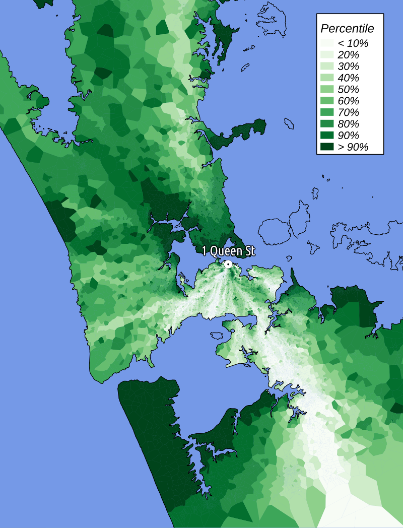
This map shows the relationship between the "direct" (crow flies) distance and "shortest path" (via roads) from 1 Queen Street (downtown) and the rest of Auckland, via the road network. Percentiles describe the relative 'directness' of the path - the lightest shade polygons are in the 10% most direct paths to town, the darkest are the 10% least direct.
This is a very simplistic analysis. I had to create my own edge network that ignores speed limits, turn and one-way restrictions and assumes that any road that crosses another will intersect. Nevertheless, it was a lot of fun to make, and I'll post a detailed account of how it was made later. It would be easy to improve and apply to other areas. Leave a comment if you have suggestions!
Downloads
Explore and download the final data set here:
Datasources
- Improved NZ Road Centrelines (August 2011) (NZ Open GPS Maps)
- NZ Coastlines and Islands Polygons (Topo 1:250k) (LINZ)