Rivers of New Zealand

New Zealand's Ministry for the Environment recently launched their new Data Service. It's another excellent source of open data and a sign that the 'open data dam' has truly burst.
One of the most interesting datasets in the service is the New Zealand "River Environment Classification" set.
The New Zealand River Environment Classification (REC) organizes information about the physical characteristics of New Zealand's rivers. Individual river sections are mapped according to physical factors such as climate, source of flow for the river water, topography, and geology, and catchment land cover eg, forest, pasture or urban. Sections of river that have similar ecological characteristics can then be grouped together, no matter where they are.
I highly recommend you go read Chris McDowall's blog post where he maps the data and provides some insight into its structure. Chris uses the stream order (an indication of how many upstream tributaries feed into a particular segment) which gives a fascinating insight into the structure of rivers.
Incidentally, as a software developer, this dataset is also interesting in that it represents a directed tree graph, and there are lots of graphing options we could use to explore the data in a logical rather than physical sense.
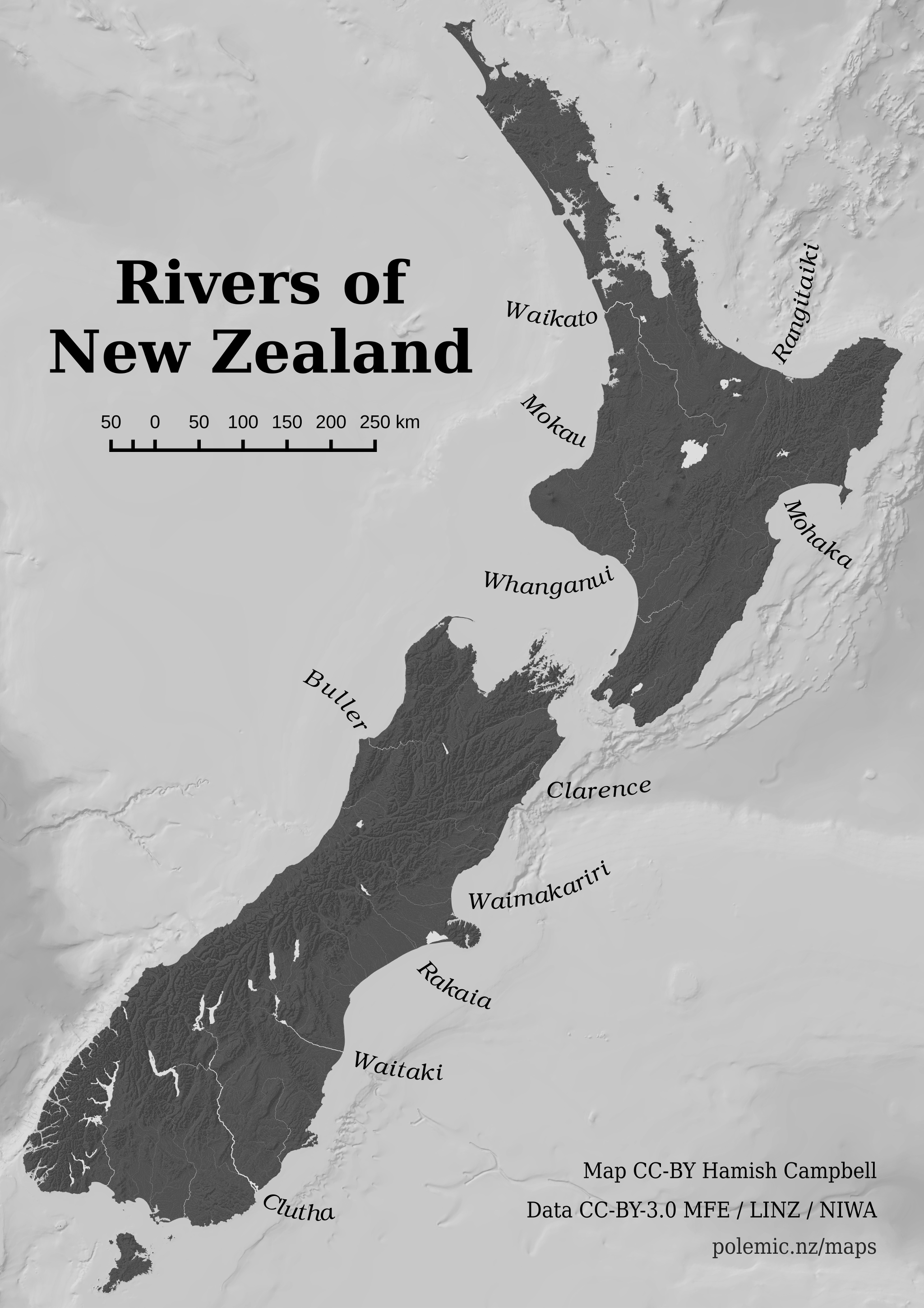
The data also includes catchment information, and for each segment it provides the total cumulative catchment are for the segments tributaries. This is the field used for the river widths in the map above, weighted non-linearly so we can still see the smaller river segments (at least, in the larger download below). Labels are somewhat arbitrarily applied, to highly some of the large outlets.
Downloads
Data Sources
- River Environment Classification (MfE)
- Coastlines and Lake Polygons (LINZ)
- NZ 250m Bathymetry Rainbow (NIWA)